
7. BRAZIL – GRAND CIRCUIT
WHERE? Chapada Diamantina
LENGTH: 100km DAYS: 5-6
DIFFICULTY: Moderate
THE WALK: Despite its size, Brazil isn’t big on trekking. But the country’s stand-out hike has to be the Grand Circuit of Lost World-like Chapada Diamantina National Park. Starting from Lencois, the route loops up and down amid the distinctive table-top massifs, passing wide plateau, emerald valleys and dive-in-able pools. Meet the hippy alternativo residents of the Vale do Capao; admire 400m-high Cachoeira da Fumaca, one of the highest waterfalls in Brazil; detour to the stone ruins at Igatu; and keep a lookout for birds and orchids amid the foliage. Also, villages and pousada accommodation en route mean you don’t have to spend every night under canvas.
MORE INFO: Lencois is 400km from Salvador; buses take around 6hrs.
LIKE THAT? TRY THIS… Try a hike in Brazil’s Chapada dos Veadeiros NP – cascades, canyons and Indian communities but also fewer tourists.
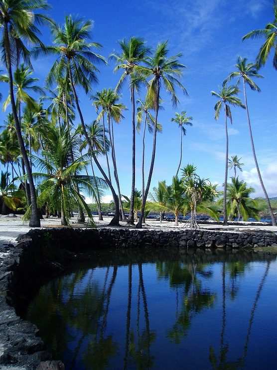
8. CHILE – W TREK
WHERE? Torres del Paine
LENGTH: 60km DAYS: 5-7 days
DIFFICULTY: Moderate; the weather can be bad
THE WALK: This is Patagonia’s most popular trek for a reason – it combines close-up views of those classic Cuernos (horns) with manageable walking between comfortable mountain huts. Though not as completist-satisfying as the longer Circuit Trek, the W sticks to the mountains’ south side – blessed with some of the best lookouts and, often, better weather. Taking in the park’s three main valleys: the Ascensio, for those perfect granite-spire views; French Valley, where glaciers hang; and alongside Grey Lake, which leads up to the edge of the Patagonian Ice Cap. Also expect soaring condor, flamingos wading in the lagoons, and – maybe – the thrilling flash of puma.
MORE INFO: Torres del Paine is 115km from Puerto Natales; the nearest airport is at Punta Arenas, 225km from Puerto Natales.
LIKE THAT? TRY THIS… Got less time in Torres del Paine? Try the Lookout Trek (34km). Got more? Extend to the Circuit (130km).
9. PERU – EL MISTI
WHERE? Near Arequipa
LENGTH: 25km DAYS: 2-3 days
DIFFICULTY: Moderate, if acclimatised
THE WALK: At 5,822m, El Misti is only about 80m short of Kilimanjaro but if it can’t claim to be the tallest on its continent, like the Tanzanian volcano, El Misti still offers non-climbers the chance to bag an impressive peak. The trek up El Misti, which looms over pretty Arequipa, is a slog-challenge rather than a technical prospect (though you might need an ice axe and crampons, depending on the season). There are several routes up its slopes of lava and ash. Base camp teeters at 4,500m; from there it’s around a five-hour climb to the top, where you’ll find a 10m-tall iron cross and a sulfurous crater – El Misti is still active, last erupting in 1985. In 1998, six Inca mummies were found here – you can see them at Arequipa’s Museo de Santuarios Andinos.
MORE INFO: Best to travel with a guide; tours can be arranged from nearby Arequipa. Chiguata, a popular trailhead, is a 45min drive from Arequipa.
LIKE THAT? TRY THIS… Conquer Argentina’s 6,962m Aconcagua, South America’s highest.

10. BOLIVIA – CONDORIRI TREK
WHERE? Cordillera Real
LENGTH: 42km DAYS: 4
DIFFICULTY: Moderate-Tough
THE WALK: The Cordillera Real is a holy-moly mountain range: a gasp-inducing 120km-long swoop of glacier-cloaked granite peaks, eight of which soar over 6,000m. It’s utterly wild -yet sits within boot-throwing distance of capital, La Paz. There are lots of fine hikes here, though many – largely on account of that extreme altitude – are tough. However, if you’ve already spent time acclimatising to breathy Bolivia, the Condoriri Trek, from Lake Tuni to Huayna Potosi, is an excellent option. The Condoriri is a varied mini-range within the cordillera, where you can hike amid mountains, hanging glaciers, grazing guanacos and sublime-blue lakes, making camp by the water’s edge. The walking, on rough trails and sometimes snow, isn’t too challenging in itself but the passes – you’ll tackle one a day – are high indeed, topping 5,000m: it’s sure to test your lungs but also offer it-was-worth-it views.
MORE INFO: Lake Tuni is about 60km north of La Paz. There is no public transport but, if you are not on a guided trek, reasonably priced private transport can be arranged via agencies in the capital.
LIKE THAT? TRY THIS… Think you’re tough, and totally acclimatised? Then try the full Transcordillera, a 12-14 day arduously amazing challenge right across the Real.
11. VENEZUELA – RORAIMA
WHERE? Canaima National Park, Venezuela
LENGTH: 95km DAYS: 5-6
DIFFICULTY: Moderate-Tough; the big battles are with conditions and flies
THE WALK: Hiking up 2,810m Mount Roraima, the most famous of the Gran Sabana’s 115 tepuis (table-top mountains), isn’t that hard. Or at least it wouldn’t be, were it not for the choking humidity, virtually daily downpours, slippery rocks and armies of jejenes, the insatiable biting sandflies that seem set on defending Roraima’s flanks. But battling such adversity is one of the strange draws of a hike here; it’s almost as if you have to prove your worth to be permitted access; only those who pass the tests get to enter the Lost World that is Roraima’s plateau-summit. The atmosphere up here is eerie: it’s a place of crystal valleys, carnivorous plants, ghoulish rocks and weird frogs that have developed in virtual isolation from everything else around. It’s also a place where, if the tablecloth of cloud lifts, you can gaze out over Venezuela, Guyana and Brazil – Roraima marks the meeting point of the three countries.
MORE INFO: The trailhead at Paraitepui is a 28km drive off the Trans Amazonian Highway at San Francisco de Yuruam.
LIKE THAT? TRY THIS… Try an alternative tepui: 2,450m Auyan-tepui is the largest in Canaima NP, with a vast summit plateau; also Angel Falls tumbles down its side.
12. PERU – AUSANGATE CIRCUIT
WHERE? Cordillera Vilcanota
DIFFICULTY: Tough; very high altitudes
THE WALK: Imposing Ausangate (6,380m) is one of the highest peaks near Cusco, and perhaps the holiest: the local Andean people believe it is home to their gods. This trek does a circuit around it, offering up multicoloured lakes and views of mighty mountains with plenty of local culture: you’ll pass traditional villages (where you can dip in a hot spring) and gaggles of ladies wearing be-tasseled flatboard hats. Best of all, it’s a trek of diversity, with varied hiking across puna (high meadows), along valley floors, via blue-green lagoons and over lofty passes (some around 5,000m), where condors hover and fluffy viscachas scutter.
MORE INFO: The trek starts at Tinqui, around 80km east of Cusco. Buses from Cusco takes 6hrs. LIKE
THAT? TRY THIS… If you’re avoiding the Inca Trail, but still want to hike to Machu Picchu, try hiking there via the impressive Choquequirao ruins or along the lesser-used Salkantay Trail.