Gone walkabout

After4WD explorations, several Aborigine encounters and a few discussions in broken English about songlines, I felt I needed to set aside the theory and do what the locals used to do: head out into the bush, use my feet and go walkabout.
The Kings Canyon rim trail is only around seven kilometres long, but in the blazing afternoon heat, with a few stunted ghost gums and small blue mallee trees for shade, it’s still quite a hike. The trail began with a steep stone staircase that deposited me on a clifftop with breathtaking views over the desert and the Watanka National Park.
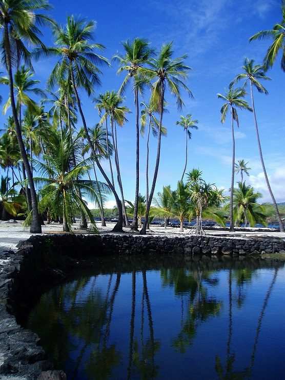
Kings Canyon, which dates back some 400 million years, was shaped by hugs inland lakes. When l took a short diversion to visit the so-called ‘Garden of Eden’, l was plunged into a shady hollow of prehistoric palms, and a short track that led to attempting pool. I say tempting because a sign advised this was a sacred site. I didn’t mind the restriction, and spent the time imagining ancestral Australians coming here, like me, to escape the heat, rest on a ledge, eat a berry (in my case, an Anzac biscuit). They may have caught a wallaby unawares and returned to camp with a feast. Perhaps they communed with their gods awhile – after all, their gods inhabited the very rocks on which they were resting.
The journey to Kings Canyon afforded me a few glimpses into the complexity of the white and indigenous-Australian covenant. While the native peoples theoretically “own” their ancient lands, most of the Red Centre is occupied by vast cattle stations. Around Mount Conner, a monolithic table mountain often mistaken by tourists for Uluru, the dry, dusty landscape studded with bushes and quandong trees reminded me of cowboy films, with exotic extras in the shape of wild camels. I saw a few of the 4,000-odd head of cattle that roam freely this 4,150 sq km station, as well as a couple of shy kangaroos and a fleet-footed dingo mother with three cubs.
All roads in the Red Centre eventually lead to Alice Springs. Here I saw how the rock art inspired many of the mesmerising modern works hanging in the dozen or so local galleries, as well as a laser installation projected on to the MacDonnell Ranges that told the Aboriginal story of a caterpillar who – through the storm of metamorphosis – became a butterfly.
Alice gave me the opportunity to ride on a camel – less bumpy than I expected – and to explore the hilly banks of the Todd River on some excellent mountain biking routes. Towards the end of a sweaty, breathless three-hour pedal up and down steep, rock-strewn paths, I had to slam on the brakes to avoid riding over the tail of a giant perentie lizard – which features prominently in Aboriginal legend, and diet.

But the most exhilarating way to explore the Red Centre is, paradoxically, to swim it. Australia sits on – but is not riven by – a tectonic plate, and consequently has some of the most ancient landscapes on Earth. Time and weather has smoothed and flattened the peaks and sent rivers meandering in to deserts or even beneath the ground. But they have left behind a few dramatic clefts in the range. At Simpson Gap, Standley Chasm, Ormiston Gorge and Ellery Creek Big Hole, I walked or, where possible, swam in waterholes beneath cliffs and buttes of crumbling sandstone. The water was cool, the searing sun lost behind looming cliffs, and the air above my head almost silent.