The path became more technical here, with tree roots and small rocks underfoot, but the DOC has added railings where necessary. I continued to make good progress, climbing steadily towards my destination for the day – Routeburn Falls Hut. The huts are comfortable places to spend the night. Alongside other hikers I ate a simple dinner on the terrace overlooking the Routeburn Valley and Humboldt Mountains. Bunks are in a communal dorm, and all 48 were full, so there was no solitude. I was itching to get back out on the trail.
ON A HIGH – The next morning I climbed above the tree line and up towards Harris Saddle, the trail’s highest point (1,225m). One of the reasons some people say the Routeburn Track is better than the Milford is because you spend more time above the bushline and consequently get better alpine views – and it was certainly hard to imagine better views than these. Every few steps my eyes were drawn backwards down the Routeburn Valley; when I reached the saddle itself I was spellbound. This is the boundary between Mount Aspiring and Fiordland national parks, and rocky slopes covered with tussocky grass ran down from the ridge on either side. It was quite exposed to the elements, but the payoff was that feeling you only get from being on top of a mountain
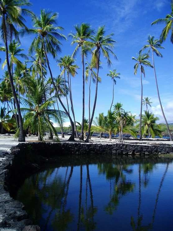
From here the track descended and soon Lake Mackenzie -and that private swimming pool – was visible below. There had been plenty of rain so Routeburn Falls was in full flow, the lakes around its bottom topped up. When 1 got down to the hut, the conservation ranger told me that these were “the Routeburn’s spa pools”. That was all the convincing I needed -it was time for that swim.

WHAT LIES BENEATH – My final day on the trail was spent descending, past the Orchard, an open grassland strewn with ribbon wood trees, the misty Earland Falls and Lake Howden Hut to reach more silver beech forest. It wasn’t until I reached The Divide – the lowest crossing of the Southern Alps, where the walk meets the Milford Highway – that I realised I hadn’t seen anyone else all day.
The Routeburn Track is officially a Great Walk and yet I’d had it all to myself, the only noise being a tiny rifleman (New Zealand’s smallest bird) vying with a persistent South Island robin. I’d timed my arrival on the road for my pre-booked bus to Milford Sound. We reached the fiord in time to join the final cruise of the day – and of my journey – with Mitre Peak Cruises, the only voyage to head right out past St Anne’s lighthouse, so you get to re-enter the sound from the Tasman Sea.
The boat glided past the unmistakable Mitre Peak, subject of so many postcards, and across the placid waters, stretched between the peaks like a sheet of shimmering tinfoil. The sound’s saltwater is covered with a layer of freshwater, which blocks the light and creates the conditions of a deep ocean at much shallower depths. Once again the meltwater of the Southern Alps is affecting the landscape. And once again I was struck by these waters’ timeless, silent strength, as they bore me back towards the verdant South Island shore.